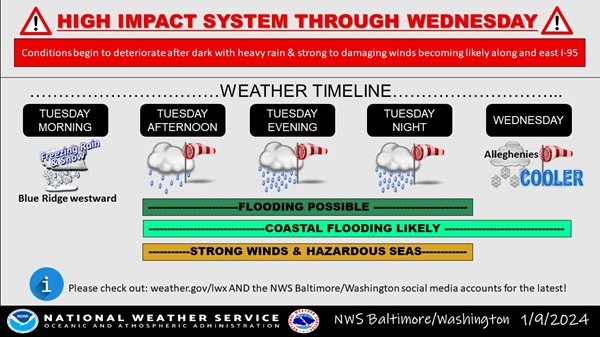
BALTIMORE, MD—The National Weather Service says weather conditions will deteriorate as a strong frontal system approaches on Tuesday afternoon, then passes through the greater Baltimore/Washington region Tuesday evening.
This will result high winds capable of downing trees and powerlines, tidal flooding, and the potential for flooding of small streams and creeks. This will create hazardous travel conditions late Tuesday afternoon and into the evening hours.
READ MORE: State officials ask residents to share flooding photos on MyCoast Maryland app
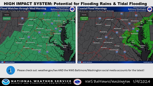
Light-to-moderate rain will continue early Tuesday afternoon, then increase in intensity later in the afternoon, with an hours-long period of heavy, intense rainfall expected between 6 p.m. and 10 p.m. This heavy rainfall, coupled with already saturated soils from recent rainfall, will cause flooding of small streams and creeks. Motorists should not attempt to drive across flooded roadways. Additionally, flooding at night increases the risk of motorists not being able to quickly identify water hazards due to decreased visibility.
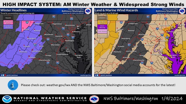
Easterly winds will increase in intensity across the region with gusts of 50 mph expected late Tuesday afternoon and evening. Locations closer to the Chesapeake Bay will see higher wind gusts of 60-70 mph. Strong winds will increase the risk of falling trees and downed powerlines. Winds should decrease after midnight tonight.
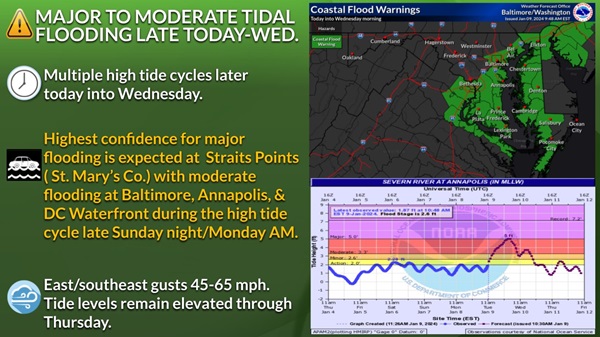
Finally, areas along the tidal Potomac River and western shore of the Chesapeake Bay north of Smith Point, VA should prepare for moderate-to-major tidal flooding. The cities of Baltimore MD, Annapolis MD, and Alexandria VA are most prone to tidal flooding, and the coupling of heavy rainfall and strong onshore winds of 50-60 mph in these locations will combine to create moderate-to-major tidal impacts.
Baltimore County Schools and offices are closing three hours early on Tuesday, as are schools in Harford County.
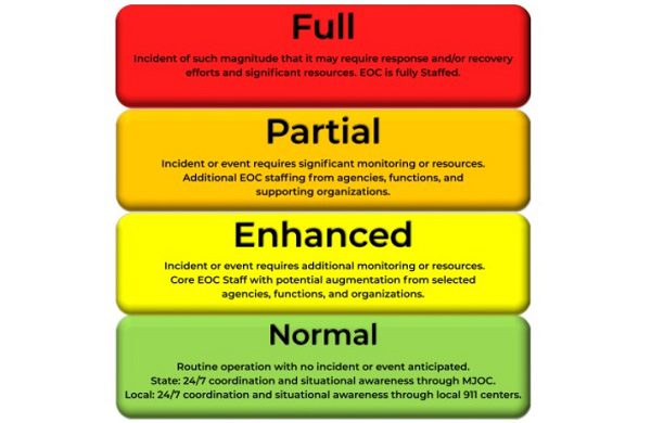
The Maryland Department of Emergency Management has announced that the State Activation Level will remain at ENHANCED throughout this weather event.
A Flood Watch, Coastal Flood Warning, and High Wind Warning are all in effect for the Baltimore area through Wednesday morning.
Baltimore County residents are encouraged to check county resources on the Office of Homeland Security And Emergency Management page and sign up for BaltCo Alert online here.
Additional information is available in the National Weather Service graphics below.
READ MORE: State officials ask residents to share flooding photos on MyCoast Maryland app