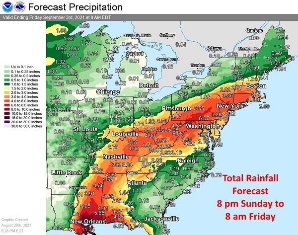
UPDATE: Forecasters now say the remnants of Ida could dump up to six inches of rain over parts of Maryland.
Original story below…
——
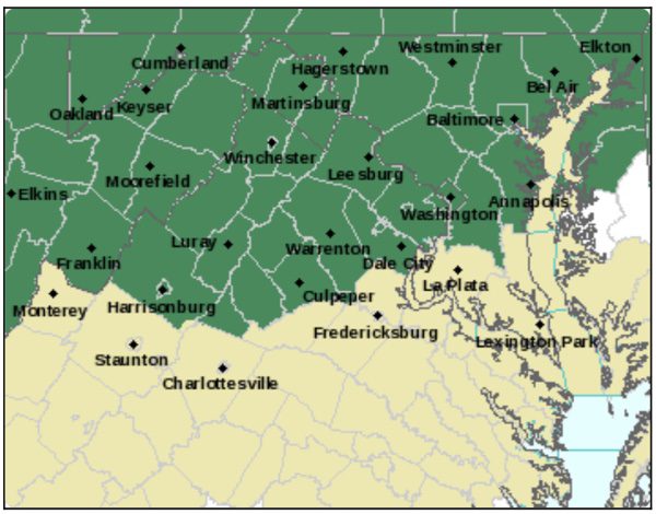
NOTTINGHAM, MD—The National Weather Service has issued a Flash Flood Watch for the Baltimore area.
The watch will be in effect from Wednesday morning through Thursday morning.
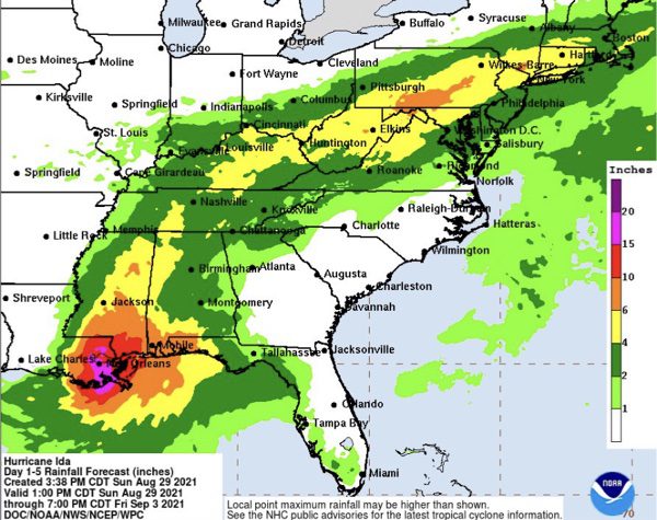
The remnants of Hurricane Ida will interact with a stalled front, resulting in a prolonged period of heavy rainfall beginning Wednesday morning and continuing through Wednesday night. Rainfall amounts of 2 to 4 inches are expected, with localized amounts up to 6 inches possible.
This amount of heavy rainfall will not only result in the potential for considerable flash flooding of creeks, small streams, and urban areas, but also the potential for river flooding.
Residents should monitor later forecasts and be prepared to take action should Flash Flood Warnings be issued.