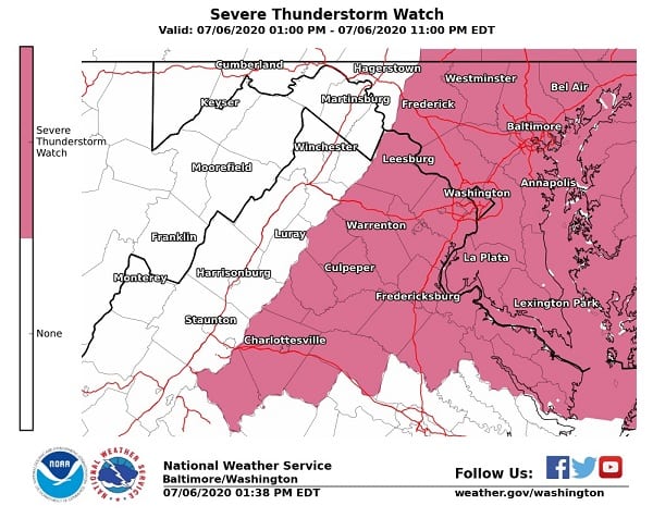
U{DATE: A Severe Thunderstorm Watch is also now in effect until 11 p.m.
Original story below…
——
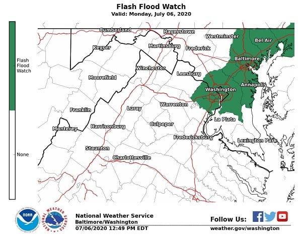
NOTTINGHAM, MD—A Flash Flood Watch has been issued for the Baltimore area for Monday afternoon and evening. The Flood Watch will be in effect until 9 p.m.
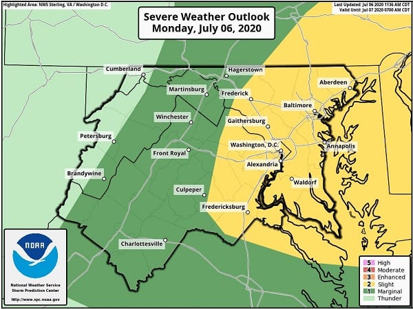
Thunderstorms will develop on Monday and continue into the evening hours along the I-95 corridor. Some areas may experience multiple thunderstorms through Monday evening.
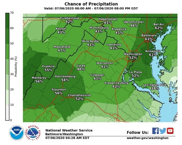
The National Weather Service says rainfall amounts of 1-2 inches are possible, with some isolated amounts over 3 inches possible. This amount of rain over urban areas may lead to instances of flash flooding, as well as a potential for creeks and streams to rise rapidly if some of the higher amounts are realized.
A Flash Flood Watch means that conditions may develop that lead to flash flooding. Flash flooding is a very dangerous situation.
Residents should monitor later forecasts and be prepared to take action should Flash Flood Warnings be issued.
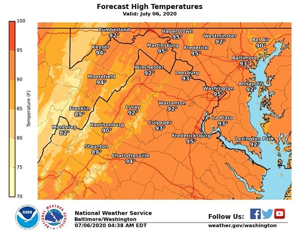
Highs on Monday will reach the mid-90s in most areas, with plenty of humidity.
Additional information is available in the graphics below.