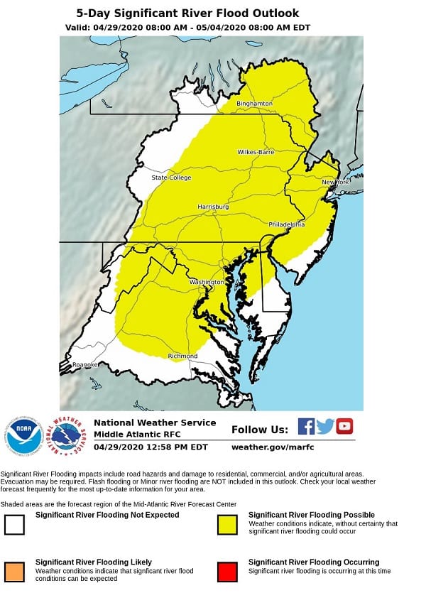
UPDATE: National Weather Service Middle Atlantic River Forecast Center has issued a Significant Flood Outlook for the area. See updated graphic below.
Original story below…
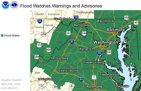
BALTIMORE, MD—The National Weather Service has issued a Flood Watch and a Coastal Flood Watch for the Baltimore area.
The Flood Watch will be in effect from 4 a.m. through 10 p.m. on Thursday.
Widespread heavy rainfall is expected Thursday afternoon into Thursday evening along and ahead of a strong cold front.
Rainfall totals of 1.5 to 2.5 inches are expected with the potential for up to four inches.
This amount of rainfall will likely result in small stream and main stem river flooding. Moderate river flooding is also possible.
One to two feet of inundation above ground level possible in low lying areas due to tidal flooding.
A Coastal Flood Watch has also been issued for Baltimore City and for the Bowleys Quarters area in Middle River.
Tides 2.5 to 3 feet above normal are expected on Thursday. The high tides at Fort McHenry Baltimore will be at 12:48 p.m. on Thursday and at 1:35 a.m. on Friday. The high tides at Bowley Bar will be at 2:12 p.m. on Thursday and at 2:48 a.m. on Friday.
If travel is required, motorists should allow extra time as some roads may be closed.
Motorists should not not drive around barricades or through water of unknown depth.
Residents should take necessary actions to protect flood-prone property.