
UPDATE: A Tornado Watch is also now in effect.
Original story below…
———
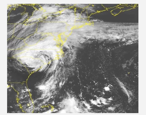
BALTIMORE, MD—The National Weather Service has issued a Flood Watch for the Baltimore area as the remnants of Tropical Storm Debby approach the region.
The Flood Watch will remain in effect through 9 p.m. on Friday, August 9, 2024.
The remnants of Debby will move northward through the Baltimore area, leading to heavy rainfall on Thursday evening and into Friday. A widespread 2 to 4 inches of additional rainfall is expected within the Flood Watch area, with localized storm totals up to 6 inches.
Excessive runoff may result in flooding of rivers, creeks, streams, and other low-lying and flood-prone locations.
Residents should monitor later forecasts and be prepared to take action should Flash Flood Warnings be issued.
Meanwhile, State Highway Administration crews are preparing for Debby’s arrival and Governor Moore is urging caution.