UPDATE: A Winter Weather Advisory has been issued for the Baltimore area and portions of the Eastern Shore are now under a Blizzard Warning.
Original story below…
——
NOTTINGHAM, MD—With just under 24 hours to go until snow begins falling in Maryland, there is still a great deal of uncertainty regarding the exact track of the approaching winter storm.
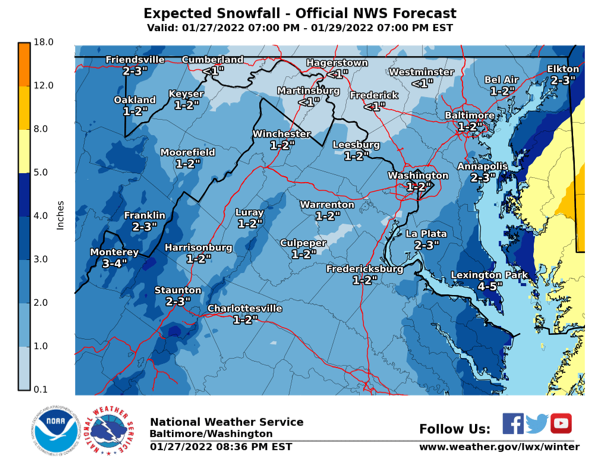
In and around the Baltimore area the National Weather Service is calling for around an inch or two of accumulation, however the “high end” estimate shows 5 – 8 inches of accumulation while the “low end” estimate shows a complete miss for Baltimore.
Forecasters say a mix of rain and snow will begin falling in the early afternoon before changing to all snow by Friday night.
Saturday will be cold with snow spreading over the area and dangerously cold wind chills. Snow will likely accumulate throughout the day with higher amounts in southern Maryland.
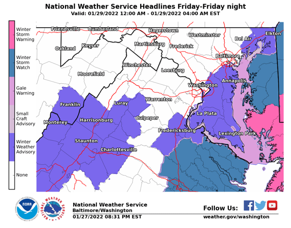
For now, a Winter Storm Warning has been issued for Cambridge, Salisbury, Crisfield, Princess Anne, Snow Hill, Ocean City, Chincoteague, Wallops Island, Melfa, Exmore, Cape Charles, Cheapside, Fishermans Island, Kiptopeke, Kiptopeke State Park, and Plantation.
A small change in the storm’s trajectory could have a big impact on snow totals in and around Baltimore.
Residents should stay tuned to local forecasts.