NOTTINGHAM, MD—The only thing that’s certain when it comes to winter storms is that nothing is certain.
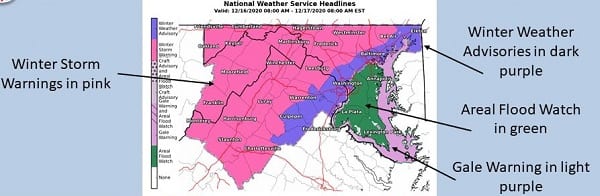
As of Tuesday afternoon, the National Weather Service has downgraded the Nottingham area to a Winter Weather Advisory for Wednesday. The Winter Storm Watch is no longer in effect.
The Winter Weather Advisory will be in effect from 10 a.m. Wednesday until 1 a.m. on Thursday.
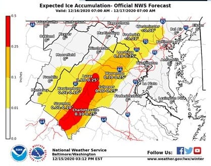
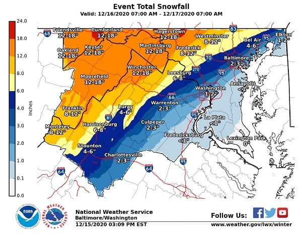
Forecasters say mixed precipitation is now expected. Total snow and sleet accumulations of 1 to 3 inches and ice accumulations of around one tenth of an inch are possible.
Snow is expected to enter the Nottingham area between 9 a.m. and 11 a.m. and then change to sleet and freezing rain during the mid-afternoon hours.
Motorists should plan on slippery road conditions. The hazardous conditions could impact the morning or evening commute.
The cutoff line between the Winter Storm Warning and Winter Weather Advisory remains very sharp. A small shift in the storm’s track could change snowfall amounts significantly.