UPDATE: The Tornado Warning has been cancelled, however a Tornado Watch remains in effect until noon.
Original story below…
———
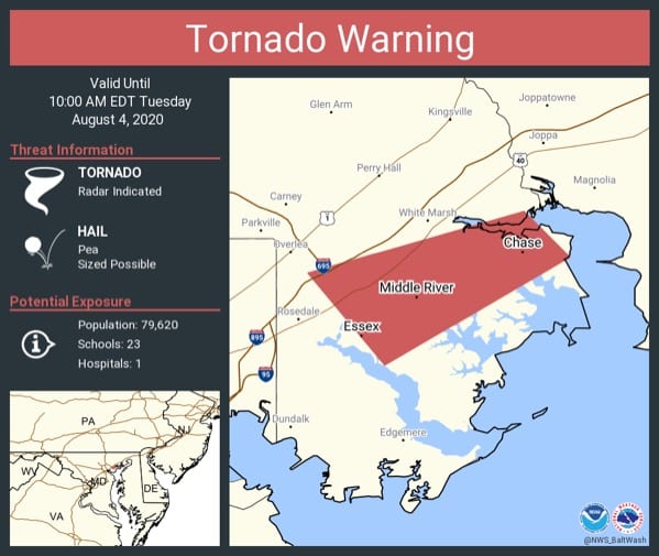
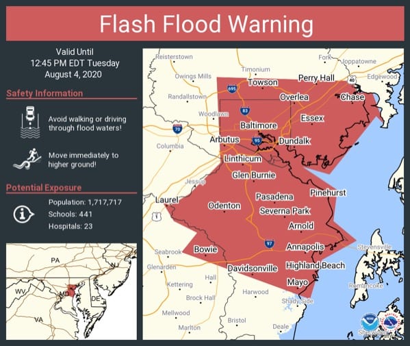
NOTTINGHAM, MD—As Tropical Storm Isaias passes through Maryland, the National Weather Service has issued a Tornado Warning and a Flash Flood Warning for portions of Baltimore County.
The Tornado Warning will be in effect until 10 a.m. and affects White Marsh, Nottingham, Middle River, Bowleys Quarters, and Essex.
The Flash Flood Warning affect Carney, Perry Hall, Nottingham, and White Marsh and will be in effect until 1 p.m.
At 9:30 a.m., a severe thunderstorm capable of producing a tornado was located near Middle River, moving southwest at 20 mph.
For those in the direct path of a tornado touchdown, flying debris will be dangerous to those caught without shelter. Damage to roofs, siding, and windows may occur. Mobile homes may be damaged or destroyed. Tree damage is likely.
Locations impacted include… Middle River, Essex, Rosedale, Rossville, White Marsh, Bowleys Quarters, Nottingham, Martin State Airport and Chase.
Heavy rainfall may hide this tornado. Do not wait to see or hear the tornado. TAKE COVER NOW!
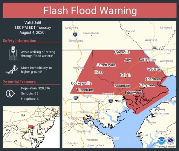
At 9 a.m., Doppler radar indicated thunderstorms producing heavy rain across the area. Up to two inches of rain have already fallen. Rain of one to two inches is expected within the next hour. Flash flooding is ongoing or expected to begin shortly.
Motorists are urged to turn around, don’t drown when encountering flooded roads. Most flood deaths occur in vehicles.
A Flash Flood Warning means that flooding is imminent or occurring. If you are in the warned area move to higher ground immediately. Residents living along streams and creeks should take immediate precautions to protect life and property.