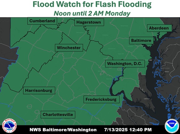
BALTIMORE, MD—The National Weather Service has issued a Flood Watch for central and western Maryland.
The watch is in effect from noon on Sunday, July 13th until 2 a.m. on Monday, July 14th.
Forecasters say showers and thunderstorms will form Sunday afternoon and linger on and off through the first half of the night. Storms will be slow-moving and capable of producing very heavy rainfall.
Rainfall totals of 1 to 2 inches appear likely for locations that receive thunderstorms, with isolated totals of 2 to 4 inches.
The strongest thunderstorms may be capable of producing 1.5 to 2.5 inches of rain per hour.
Excessive runoff may result in flooding of rivers, creeks, streams, and other low-lying and flood-prone locations.
Residents should monitor later forecasts and be prepared to take action should Flash Flood Warnings be issued.
