UPDATE: A Severe Thunderstorm Watch has been issued for much of the state.
Original story below…
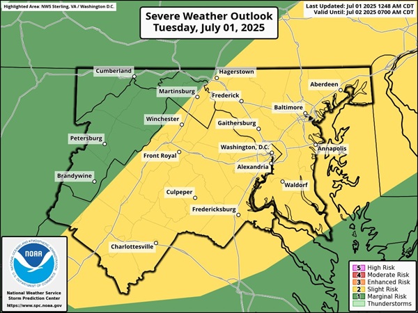
BALTIMORE, MD—The National Weather Service has issued a Flood Watch for the Baltimore area as more severe storms are expected on Tuesday.
The watch will be in effect from 2 p.m. until 11 p.m. on July 1, 2025.
Forecasters say numerous thunderstorms are expected to form and move across the area on Tuesday afternoon and evening. While thunderstorms will move along at a decent clip, they will be capable of producing very heavy instantaneous rainfall rates, and may exhibit some “training” motion at times.
Multiple rounds of thunderstorms may be possible at any single location. In total, a widespread 1 to 2 inches of rain is expected, with embedded higher totals of 2 to 5 inches. Flash flooding may occur as a result.
Monday evening’s severe storms prompted tornado warnings, flood warnings, water rescues, and several homes were also struck by lightning. A funnel cloud was also spotted forming over the Glen Arm area.
Residents should monitor later forecasts and be prepared to take action should Flash Flood Warnings be issued.

Heads up. There is a moderate risk (level 3 of 4) for excessive rainfall for a portion of the Mid-Atlantic this afternoon into tonight. There is a broader area of marginal to slight risk for excessive rainfall and severe thunderstorms across much of the eastern US. pic.twitter.com/bxAPmCEIzO
— NWS Eastern Region (@NWSEastern) July 1, 2025
