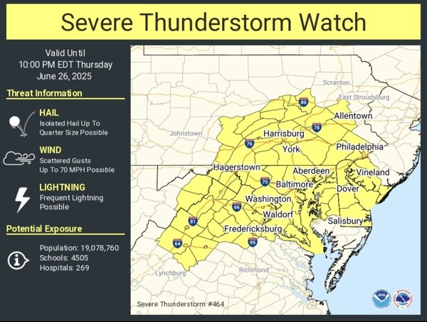
UPDATE: A Severe Thunderstorm Watch has also been issued until 10 p.m. on Thursday.
Original story below…
———
BALTIMORE, MD—The National Weather Service has issued a Flood Watch for the Baltimore area.
The watch will remain in effect until midnight on Thursday, June 26, 2025.
Forecasters say numerous thunderstorms are expected to develop later Thursday afternoon and continue through late Thursday evening ahead of an advancing front moving in from the northeast.
As these boundaries collide, slow-moving, training thunderstorms are possible, particularly along the I-95 corridor.
Rainfall amounts of 1 to 2 inches are possible, with isolated amounts up to 4 inches in some areas. This could occur over a short period of time, potentially resulting in flash flooding.
Excessive runoff may result in flooding of rivers, creeks, streams, and other low-lying and flood-prone locations. Flooding may occur in poor drainage and urban areas.
Motorists are reminded to “turn around, don’t drown.”

