
BALTIMORE, MD—The Maryland Geological Survey has embarked on a mission to map the Chesapeake Bay’s bottom, using advanced technology to create a detailed picture of the underwater landscape. This initiative aims to identify suitable areas for oyster restoration, crucial for the health of the Bay’s ecosystem.
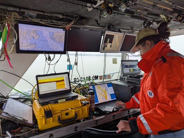
Using a custom-built boat equipped with interferometric side-scan sonar, a magnetometer, and a sub-bottom profiler, the team is collecting data on the sediment and underlying structures beneath the water. This equipment provides a comprehensive view of the Bay’s bottom, revealing information about its depth, hardness, and the presence of any metal objects. The data collection process is meticulous and involves following precise lines across the Bay and its tributaries. This method, akin to “mowing the lawn,” ensures complete coverage of the area. The team often works in winter months, navigating challenging conditions such as cold temperatures, ice, and wind to avoid interference from crab pot floats and other boats.
Stephen Van Ryswick, Director of the Maryland Geological Survey, emphasized the importance of this work: “We need this data to determine where the suitable bottom is…We look at where the new data gives us the most value, where new data can help us make decisions.”
The sonar technology used, interferometric swath bathymetry, allows for the collection of surface layer and depth data over a wide swath, while the sub-bottom profiler provides detailed information on the underlying sediment. Additionally, the magnetometer detects metal objects, potentially indicating shipwrecks or archaeological artifacts.
This ongoing mapping project is funded by a law passed by the Maryland General Assembly in 2022 and supports the efforts of the Maryland Department of Natural Resources to survey existing oyster reefs and identify potential future habitat. Understanding the bottom type is crucial for the successful implementation of oyster restoration projects, as juvenile oysters require a hard bottom or shell substrate to grow.
Chris Judy, shellfish division director of the Maryland Department of Natural Resources, highlighted the significance of these surveys, stating, “These surveys will update habitat maps that date back many decades.”
This article was written with the assistance of AI and reviewed by a human editor.
Photo via Maryland DNR