NOTTINGHAM, MD—A major storm system is beginning to push through the Eastern U.S. and the National Weather Service says hazards are expected to persist into the weekend.
Heavy rain and flooding is possible from the Mid-Atlantic to parts of New England through Saturday.
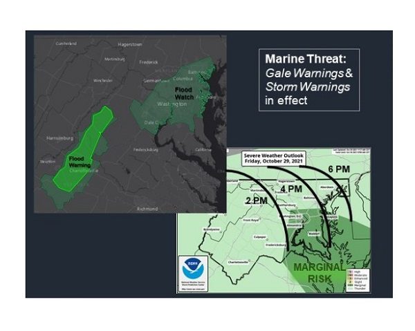
A few severe storms are possible on Friday from the Mid-Atlantic to coastal North Carolina. Any storms that develop in the Baltimore area will likely arrive 3 – 5 p.m. on Friday.
The highest tides in 10-20 years are expected, as a long duration tidal flood event affects the shores of the tidal Potomac and Chesapeake Bay.
Numerous coastal hazards are in effect, including coastal flooding and gale warnings.
Officials are urging Marylanders to use caution if they must travel on Friday.
Additional information from the National Weather Service is available below and online here.
Tidal flooding, strong winds, and severe thunderstorms capable of producing damaging wind gusts and localized rainfall flooding will impact the region. For the latest tidal flood forecasts: https://t.co/67Ghq24LYF pic.twitter.com/G1ZdkkUTcI
— NWS Baltimore-Washington (@NWS_BaltWash) October 29, 2021