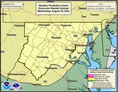
NOTTINGHAM, MD—The National Weather Service has extended and expanded the Flash Flood Watch that has been issued for the Baltimore area.
The watch has been expanded to include southeastern Harford County and southern Baltimore and it has been extended through 10 p.m. on Wednesday, August 18th.
Forecasters say multiple rounds of heavy showers and thunderstorms will affect the region from Tuesday evening through Wednesday evening.
Tropical moisture will lead to potential precipitation rates of 1 to 2 inches per hour. Localized storm total rain amounts in excess of 3 inches are possible.
Heavy rain over a short amount of time may result in rapid rises on streams and creeks and in urbanized and poor drainage areas.
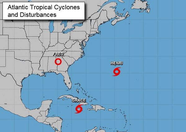
“As the remnants of Tropical Storm Fred make their way across the region, Maryland faces a threat of severe storms and flash flooding,” said Governor Larry Hogan on Tuesday. “I urge Marylanders to stay tuned to local news stations for updates, heed warnings from local authorities, and use common sense.”