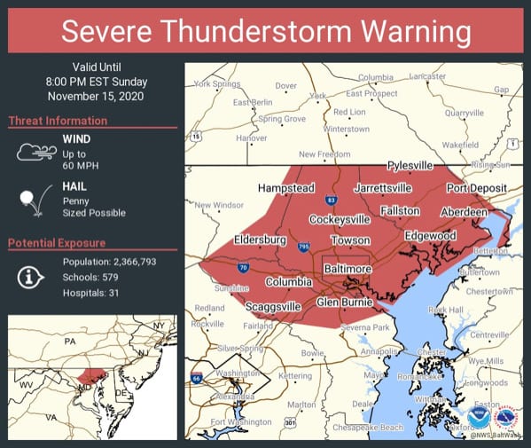
NOTTINGHAM, MD—The National Weather Service has issued a Severe Thunderstorm Warning for Baltimore and Baltimore County.
The warning will remain in effect until 8 p.m. on Sunday.
At just before 6:30 p.n., severe thunderstorms were located along a line extending from Glen Rock to near Westminster to Green Valley, moving east at 30 mph.
Wind gusts of up to 60 mph have already been observed. Damaging winds will cause some trees and large branches to fall. This could injure those outdoors, as well as damage homes and vehicles. Roadways may become blocked by downed trees. Localized power outages are possible. Unsecured light objects may become projectiles.
Locations impacted include Baltimore, Columbia, Severn, Pikesville, Parkville, Carney, Overlea, Fullerton, Rosedale, Hillendale, Perry Hall, White Marsh, Middle River, Cockeysville, Elkridge, Aberdeen, Havre De Grace, Riviera Beach, Aberdeen Proving Ground, Baltimore-Washington Airport, Fort Smallwood State Park, Millers Island, North Point State Park, Sparrows Point, Back River, Historic Ellicott City, Glen Burnie, and Ellicott City.