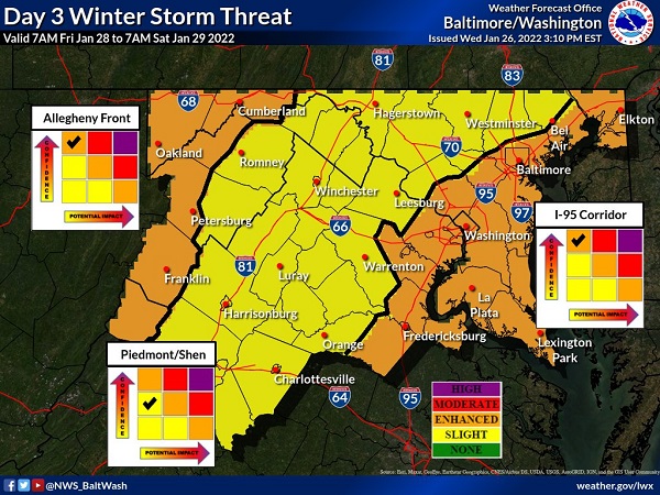
UPDATE: The National Weather Service on Wednesday afternoon said that confidence has increased further for impacts along the I-95 corridor. The graphic above from NWS has therefore been updated (the updated graphic is above).
Original story below…
——
NOTTINGHAM, MD—This weekend’s significant winter storm is heading toward the East Coast, and the National Weather Service says there is an enhanced risk of impacts along the I-95 corridor in Maryland.
Forecasters say snow will likely develop on Friday afternoon for most and continue through Saturday morning.
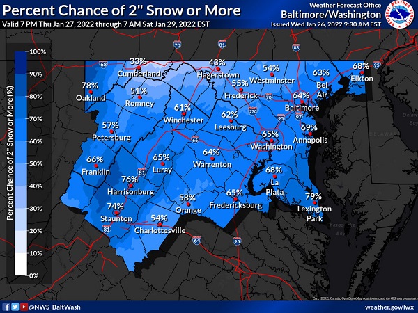
There is currently a 64 percent chance of a snowfall of two inches or more in the Baltimore area.
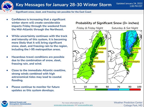
Accuweather says the storm could intensify enough from Friday to Saturday to be classified as a “bomb cyclone” as it marches up the coast toward New England.
A bomb cyclone, or bombogenesis, occurs when the central pressure of a storm crashes by 0.71 of an inch (24 millibars) or greater within 24 hours. When the pressure plummets, winds rush in toward the center of the storm at a faster pace. The winds can carry a great deal of moisture with them and unleash that in the form of copious amounts of precipitation. If the air is cold enough, heavy snow and blizzard conditions can ensue.
Residents should continue to monitor local forecasts as the weekend approaches…
x
Images via the National Weather Service