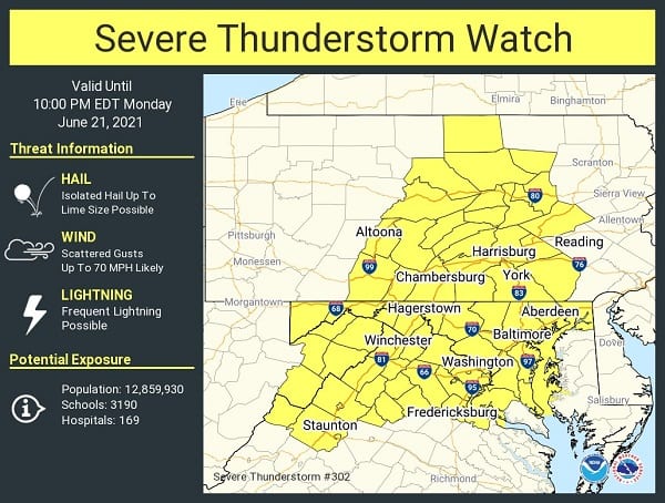
NOTTINGHAM, MD—The National Weather Service has issued a Severe Thunderstorm Watch for the Nottingham area.
The watch will remain in effect until 10 p.m. on Monday evening.
Forecasters say a line of strong to severe thunderstorms with damaging wind gusts is expected to sweep east across the Baltimore area Monday afternoon and into Monday evening.
Damaging wind gusts are the primary threat, although large hail and an isolated tornado are also possible.
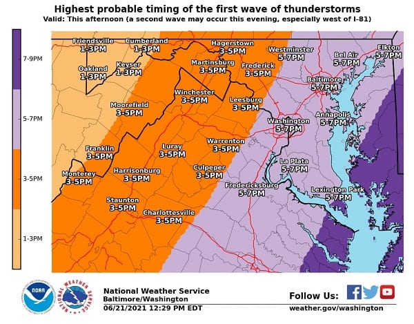
The initial line of storms should enter western Maryland and the eastern panhandle of West Virginia between 1 and 4 p.m. It is then expected to move east across the Shenandoah Valley and west central Maryland between 3 and 5 p.m.
The line of storms should reach the Baltimore metro area between 5 and 8 p.m. All times are current best estimates, and residents should be ready to seek shelter when storms threaten or warnings are issued.
Additional information is available in the graphics below from NWS.