 UPDATE: A Winter Storm Watch has now been issued. The graphic has been added at the bottom of this post.
Original story below…
——
Tuesday, March 20, will be the first day of spring, but don’t put away your winter coats just yet.
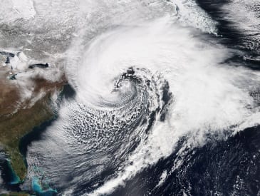
An unprecedented fourth nor’easter could potentially impact the Baltimore area from Monday night through Wednesday afternoon.
The first half of the storm is expected to arrive late Monday night into Tuesday morning with minimal accumulations, mostly on grassy areas.
The second half of the storm will involve a low pressure system forming off the coast that will affect the region Tuesday night into Wednesday.
The National Weather Service that’s where the Nottingham area could potentially expect to pick up 3 to 4 inches of snow.
Timing will be critical, as will temperatures. The high March sun angle will make it difficult for snow to accumulate during daylight hours. Temperatures will also be at or near the freezing mark, so a one-degree swing either way could make a big difference.
The latest snowfall maps from the National Weather Service can be viewed below.


